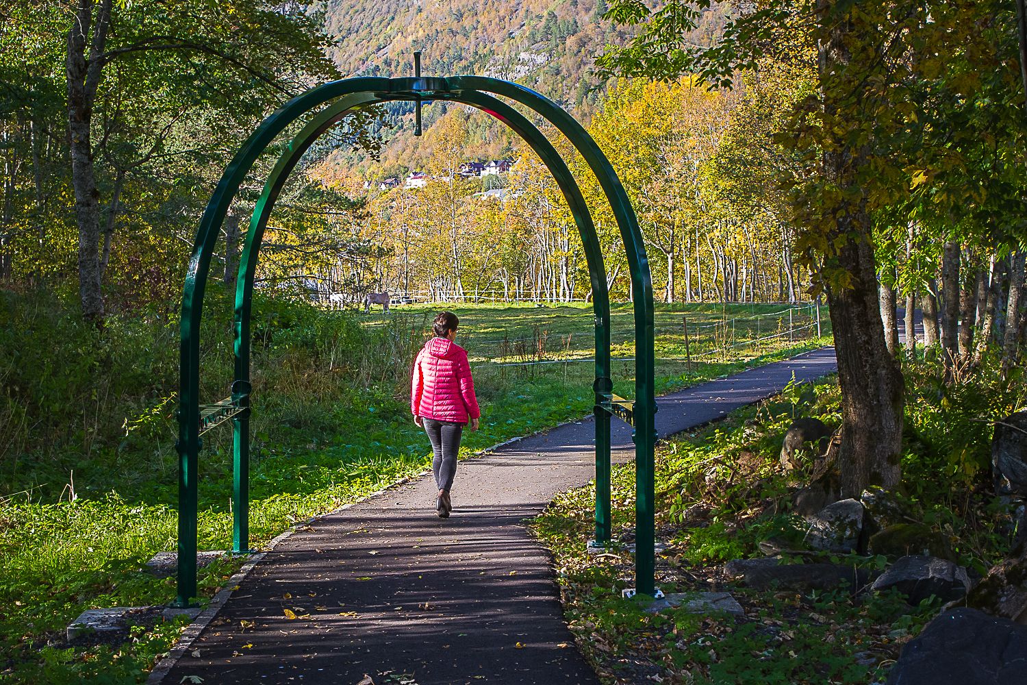
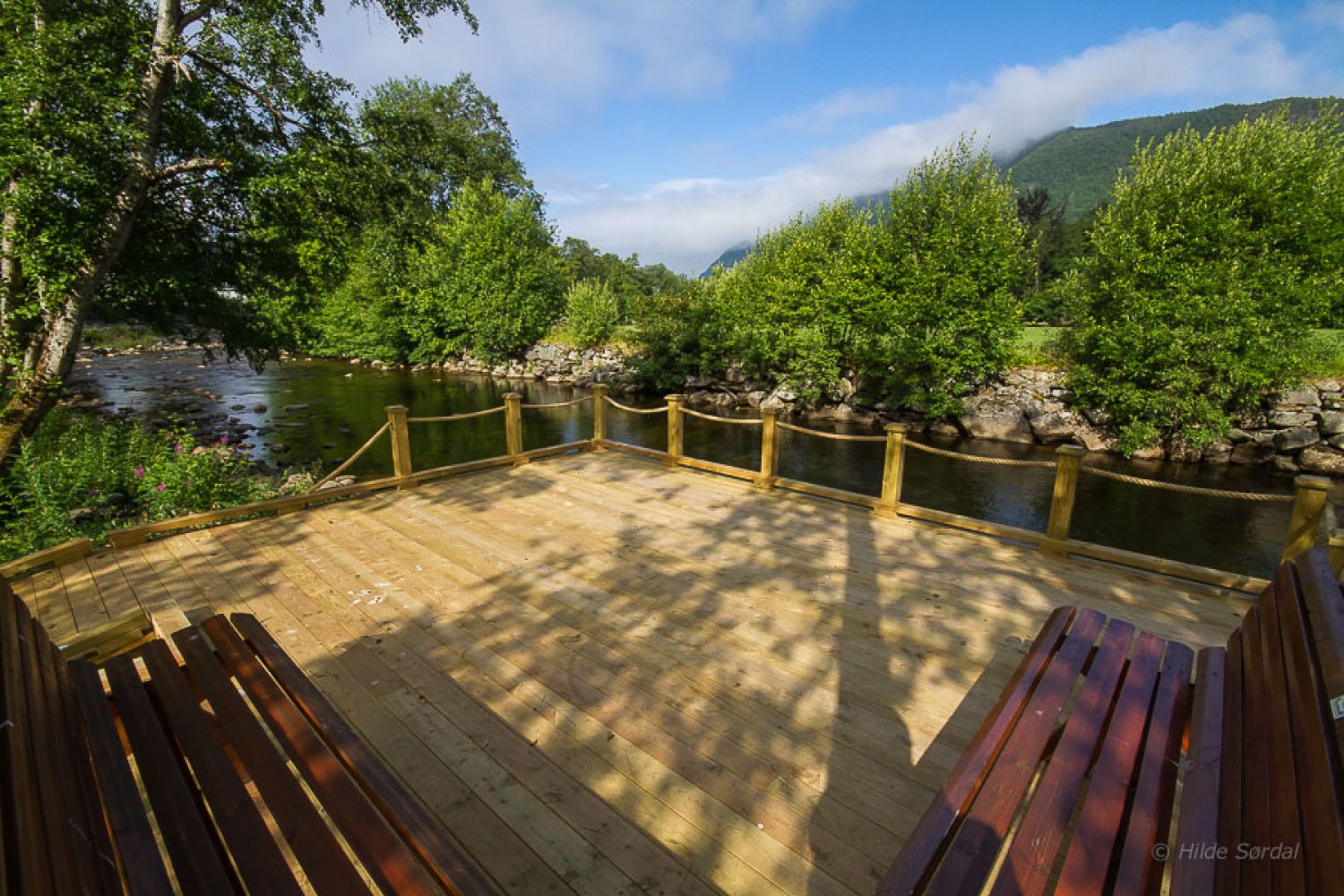
The area along the Ørskogelva River is a natural gem. The river used to be a popular swimming area and a playground for children and youth that were growing up along the river. The area has been reopened so that everyone can now use the Elvastien trail for outdoor experiences, fishing, games, and fitness. The hiking trail is evenly shaped. It has an asphalt surface, a guiding edge for directing the blind and little ascent. There are two nice picnic areas along the trail with tables, benches, and places for a fire, as well as benches to rest on at particularly beautiful spots along the river. The hiking trail has an idyllic location along the river. You will come especially close to the forces of nature as you approach the nursing homes at Smibakken. There is a nice wrought iron gate at the entrance to the Smibakken area which was created by local volunteer blacksmiths.
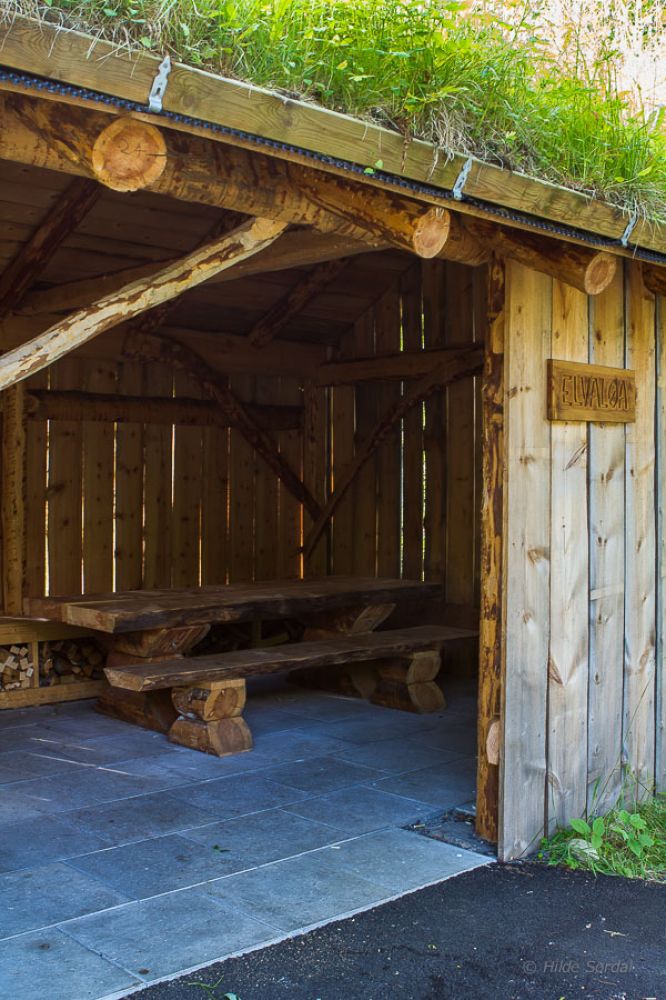
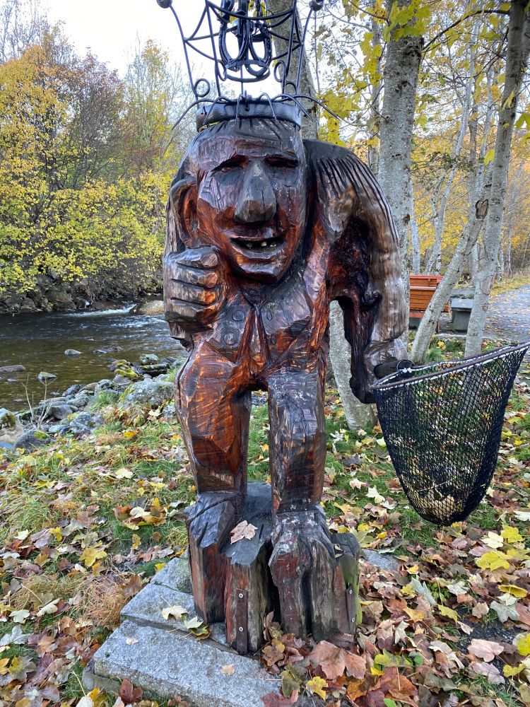
You will also find a nice trail shelter, Elvaløa, set up by the Elvaeigarlaget Association at the picnic area that is located furthest east. There is a long table, tiled floor, and a place for a fire with firewood under the bench here that everyone can use. Members of Ørskog Historical Association have prepared descriptions and old photos for the information board that you can find next to the Elvaløa trail shelter. A large fishing area with evenly shaped floor, tables, and benches was also built by the Elvaeigarlaget Association. The local artist Jørund Amdam has created 16 large and small wooden and metal figurines for the Elvastien Trail. In the summer of 2015, all figurines were restored and installed along the trail by volunteers. The large wooden sculpture Elva-Pe has been given a place of honour just by the river and the Elvaløa trail shelter. The trail is kept nice and clean by an organisation called Elvastiens Venner (Eng. Friends of Elvastien).
A trail postbox with a journal can be found near the Elvaløa trail shelter.
Route description
Start walking from Ørskog Church and go east along the Ørskogelva River. Follow the road for 650 metres along the river. This is the entire stretch of the hiking trail which you can follow in both directions. The evenly shaped surface ends where the guiding edge for the blind makes a turn.
For a nice loop trail in the centre of town, start by the church, follow the Elvastien trail, and keep walking along the existing walkway on rough gravel up a tractor road that climbs up fairly steeply. Cross the Steinholt Bridge, walk through the outdoor activity park, Bankparken, then down the pedestrian subway, and go back to the church.
Access and parking
Turn left into the centre of Sjøholt. Drive south to Ørskog Church for about 300 m.
Park your car next to Ørskog Church. There are 2 wheelchair accessible parking bays and a wheelchair accessible WC just off the car park.
Hiking route
Green
Elevation
0 m
Duration
25 min.
Sesong
Winter, Spring, Summer, Autumn
Highest Point
9 masl
Signage
Signed
Map route
Surface type
Distance
Asfalt
1,3
Public transport
Take a bus to the centre of Sjøholt and walk for about 300 metres to the starting point by Ørskog Church.