Bergsvegen - Dunderhoff - Dinglavatnet
Volda
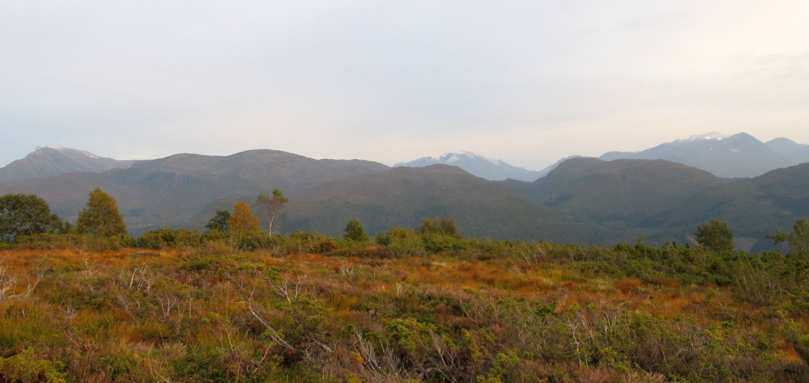
Above the village of Volda is a network of trails that lead to a variety of trips. One is this round-trip route starting at the top of Bergsvegen. Lovely terrain composed of both roads and trails. The route leads through Heltnelihuken, Kortemyra and Dunderhoff and continues to the Turnhytta cabin and up to Dinglavatnet lake. The return trip follows a slightly different route.
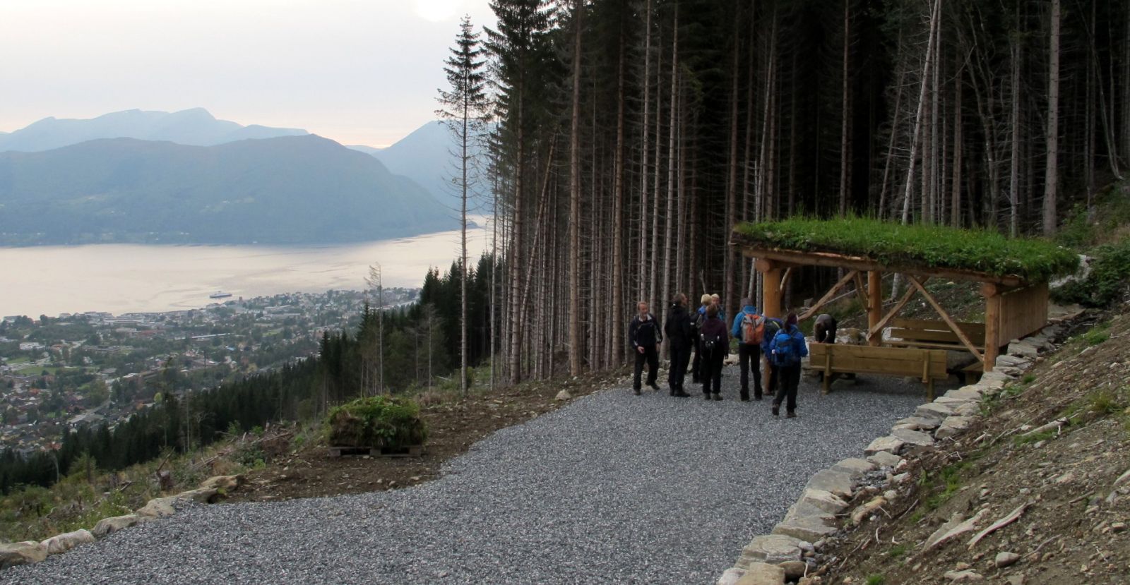
From the parking area on Bergsvegen, follow the forest road further up, about 600 m. Turn left at the spot where the road splits (follow the signs). You will soon see Heltnelihuken, which is worth a stop to admire the view. Continue along the forest road. Follow the signs to Kortemyra and Dunderhoff at the turn above Heltnelihuken. After 200-300 metres, you will see an older sign directing you to Kortemyra. Turn off on the trail here and follow the red marking posts. From Kortemyra, continue on the trail and follow the signs to Dunderhoff. Then follow the marked trail over to the Turnhytta cabin on a poorly defined path. You can use the outhouse toilet here if needed. From Turnhytta cabin, the trail continues up to Dinglavatnet lake.
You may of course follow the same route back to the starting point, but in this route description, follow the road down to the first turn (approx. 1 km). Then turn left and follow the trail directing you to Heltnelihuken. You will pass a cabin and eventually come down to a forest road, but do not take this road. Instead, follow Rasmusråsa river along the left side until you reach an elevated water reservoir. You have then returned to the starting point. The route is marked with red marking posts. The path here is good and sporadically marked. The route is also marked with signs.
From Volda centre by car: Follow the E39 in the direction of Stryn. In the roundabout by the university college, exit in the direction of Vikebygda. Follow Vikebygdvegen for 1 km. Then drive up Bakkelidvegen, Hjellbakkane and Bjørnevegen all the way until you come to Bergsvegen. Turn left and follow the gravel road up to the parking area where Panoramavegen begins, or by the elevated reservoir before the boom gate. You can either walk or cycle to the trailhead. There are many different route options.
Duration
2 t.

Sesong
Spring, Summer, Autumn
Signage
Both signed and marked
| Surface type |
Distance |
| Grus |
3 |
| Sti |
2,1 |
Bus from Volda centre to Bratteberg:
https://frammr.no/ or the entur app
Get off at the bus stop at Bratteberg school and follow the pedestrian path that leads straight up from here. Follow this to the end and then walk up Bergsvegen.
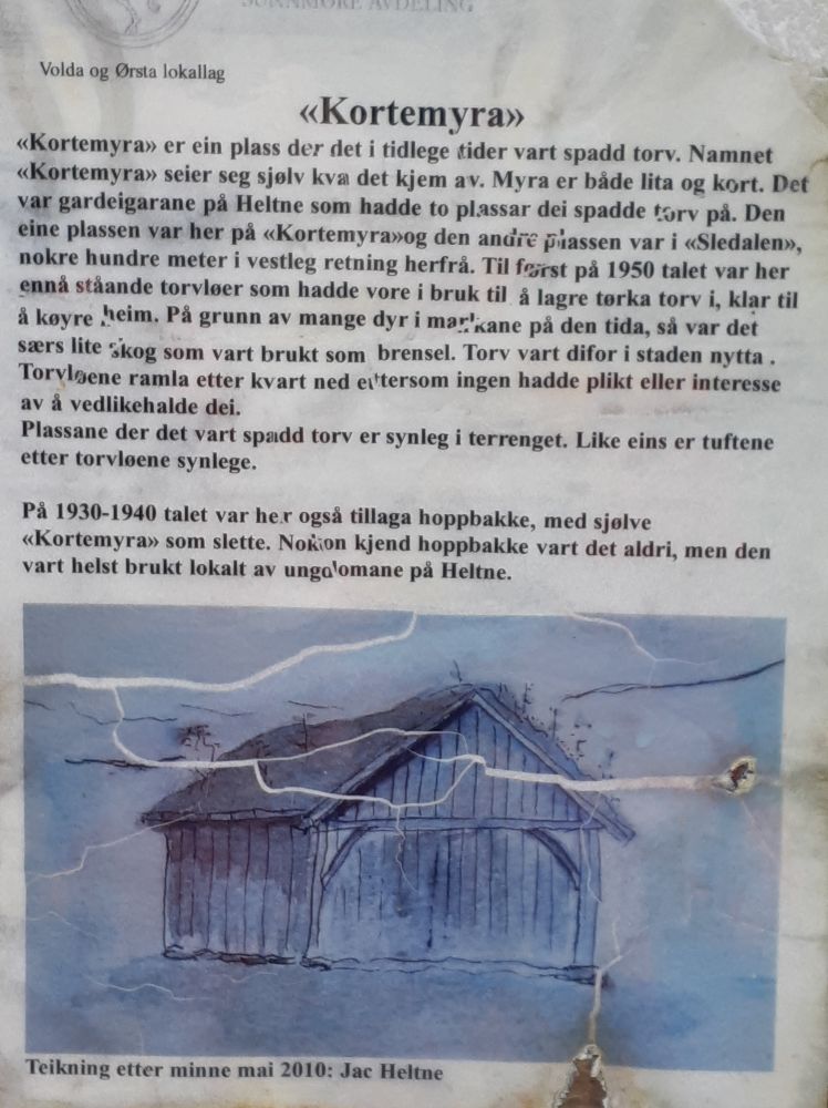
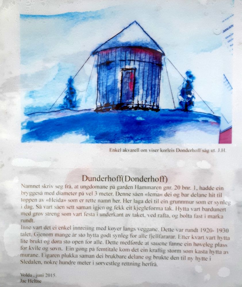
Heltnelihuken was built by the Volda Rotary Club in 2014. It is a popular destination. Kortemyra was once a place where peat was dug. The name ("short marsh") is because the marsh is small and shot (see the photo for more information). You may be wondering where the name Dunderhoff came from. You can read more about this under one of the photos. The Turnhytta cabin is owned by the sports club VTI Allidrett, and is operated by the community association Melshornets Venner ("Friends of Melshornet"). In 2015, the cabin celebrated its 100-year anniversary! If you want to rent the cabin, contact Melshornets Venner.
Local trail map for Volda. norgeskart.no
 Driving directions
 Route data
GeoJSON
Route data
GeoJSON