Blånebba from Vinddøldalen
Surnadal
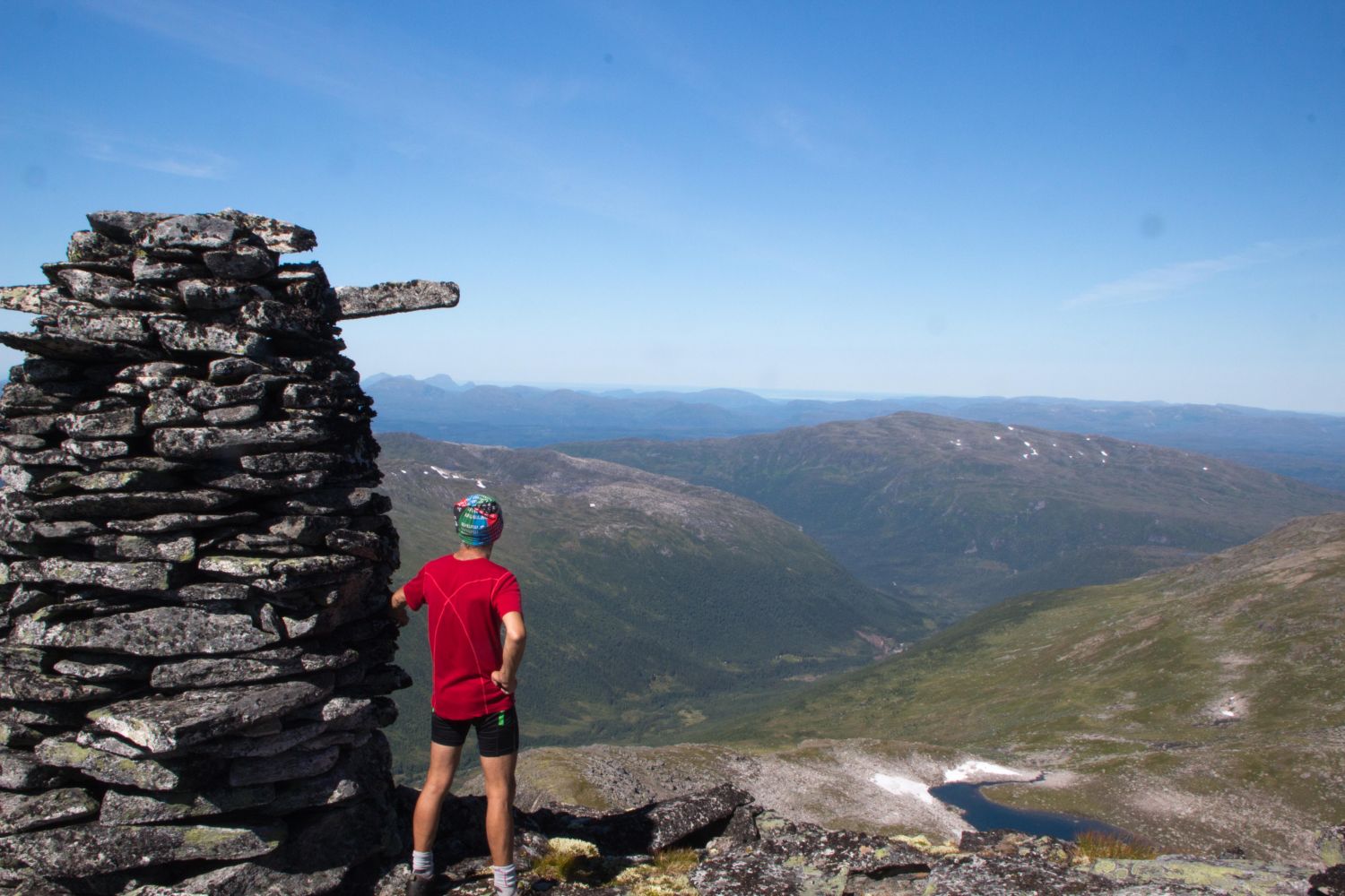
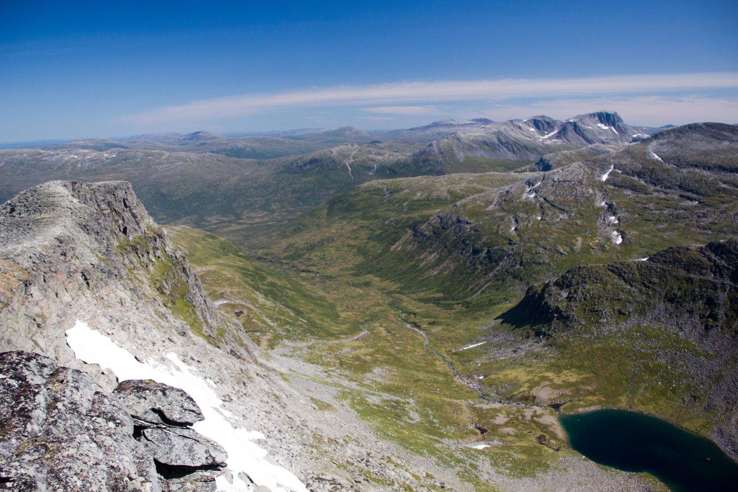
Mount Blånebba (1422 m a.s.l.) along with Fruhøtta, Pekhøtta, and Fauskånebba form a continuous mountain range with fairly steep valleys in between. A hike to Blånebba offers a variety of terrain and involves some light mountain climbing and walking along a narrow ridge.Once you reach the mountaintop, we recommend going a little further to the three large cairns at the very edge of Blånebba. You will get an amazing view of the Todalsfjorden, the Surnadalsfjorden, and even Kristiansund, Tustna, and perhaps Smøla.
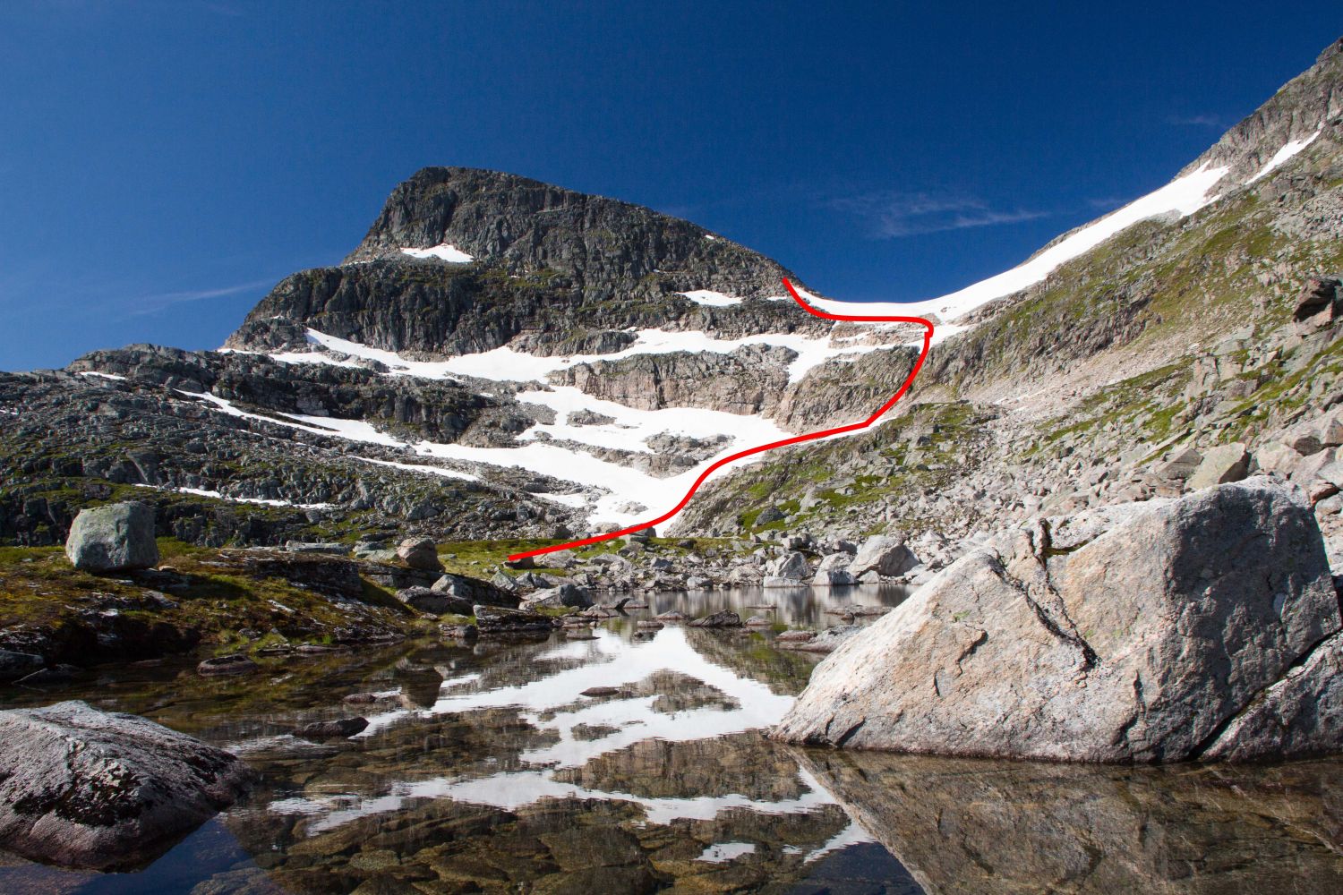
Start by walking or cycling from the car park 3 km into the valley and over the bridge near Storøya. Just after the bridge, you will find a path that climbs uphill through a cabin area. When the path disappears after the cabin area, continue moving diagonally up and walk into the valley between the mountains Langøyfjellet and Seterfjellet. After passing the small lakes, walk up the hill and into the mountain gap Eiterdalsskaret. The section of the trail from Eiterdalsskaret to another gap between the mountaintops Blånebba and Fauskånebba is steep. You will see a steep glacier here, and you might need crampons and an ice axe to climb up. In late summer, however, you can climb up the cliffs south of the glacier. The route from that gap to the point where you come up to the mountain ridge is partially marked. Follow the mountain ridge all the way to the cairn at the top.
Drive along FV65 between Surnadal and Rindal municipalities. Take the exit road that is signposted to Vindøldalen just to the west of Røv. Follow the toll road to Pebua for about 11 km. There is plenty of parking space there.