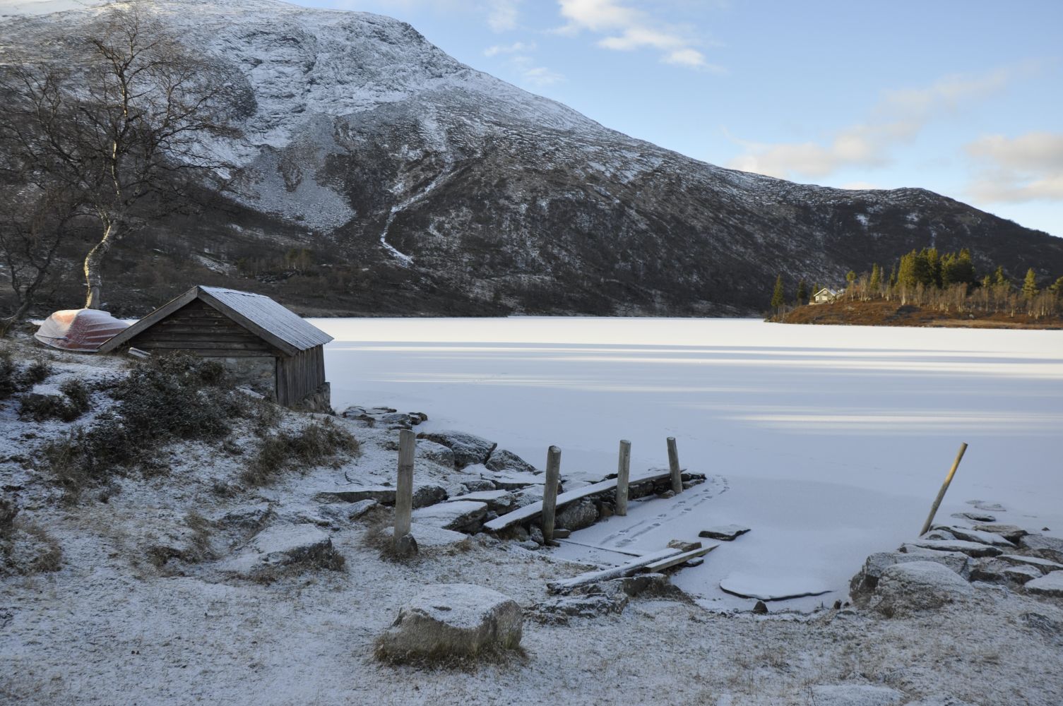
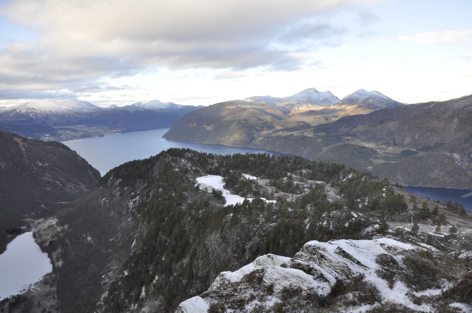
The trail to Mount Blåhornet in Eidsdal is a relatively easy mountain trail that offers a unique view without too much effort. The path is well waymarked throughout the entire trail, and it suits well both small children and the elderly. Many hikers choose to take a pooled trail via Kilstisætra on their way up or down. The path goes right next to the boathouse by Lake Kilstivatnet. You will find a place for the fire and a simple stone table with benches here. When the weather is good in summer, this place is popular among families with small children who come here to swim. Large sections of this trail cover the world heritage area West Norwegian Ford Landscape, the only area in Norway that is listed on UNESCO’s prestigious World Heritage Sites list on the basis of natural heritage.
The trail starts from Gjerdeneset, a car park you pass just before the farms in Kilsti. There is an information board at the car park with an overview of various trails in the area, their level of difficulty, as well as some general information about the area. The hiking trail is well marked with signposts from here onwards. At first, the path goes up through a marshy area. There is a steep ascent for a couple of hundred metres before you start walking along the hillside towards the bridge over the river. Walk over the bridge and up to Lake Kilstivatnet. Climb up a small hill, and you will reach the boathouse. Continue walking further for almost 200 metres until the path splits in two. Turn right (north) and walk through a marshy patch with parts of wet and muddy ground. You will then come to an old cart track which you need to follow upwards in the direction of the top of Mount Blåhornet. The cart track changes into a path once you reach a relatively large and flat marshy area. Between two small hills, you will see a sign pointing to the right (northwest) towards the top of Mount Blåhornet. The final section of the trail leading up to the top is slightly steeper. If you want to make it into a looped trail, you can follow the marked path down to Kilstisetra and along Lake Kilstivatnet back to the boathouse and Gjerdeneset.
Drive in the direction of Geiranger from the ferry terminal in Eidsdal. After about 6 km, turn off towards Rønneberg and Kilsti. Drive along the municipal road for about 5 km before you reach a car park at Gjerdeneset. You will get a great view down to Norddalsfjorden and the centre of Eidsdal from here. This is a starting point for all trails in the Kilstimarkene area.
Note: if you have any walking difficulties or you are walking with a baby carriage, you can get to Lake Kilstivatnet via the gravel road that goes through the first farmyard in Kilsti. In order to protect the landowners from the traffic going through the yard, we kindly ask you to use the marked path from Gjerdeneset, if possible.
You can park your car at Gjerdeneset. No parking fee applies.
Duration
2 t. 50 min.

| Surface type |
Distance |
| Sti |
3 |
There is not much public transport in the area. A school bus passes here during the school year.
Norddal municipality tourist map, Stranda municipality tourist map, Tafjordfjella tourist map
 Driving directions
 Route data
GeoJSON
Route data
GeoJSON