Amtlia via Solligjerdet
Surnadal
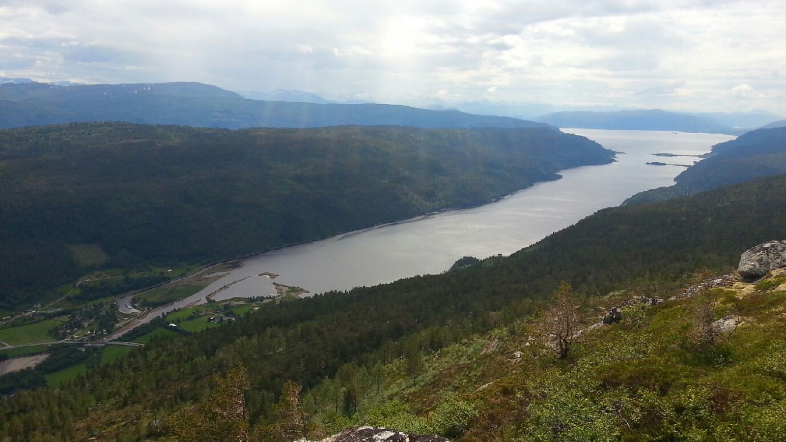
There are several alternative starting points for the hike to Amtlia Hill in Bøverfjorden. The route described here starts from the stone quarry right above the Bøfjorden and Bæverfjord educational centre. From the cairn at the hilltop, you will have a fantastic view over the Bøverfjorden mountain farms, the fjord, Surnadal, and the Trollheimen mountain range.
Drive to Bøverfjorden and take the turn up Bøverdalen. A couple of hundred metres after passing the Bøfjorden and Bæverfjord educational centre, you will see a stone quarry on the left side of the road. Follow the forest road as it takes you up the hill from here. Continue walking along the path towards Solligjerdet. Here, you can see some traces of the buildings that date back to the time when the area was inhabited several hundred years ago. Keep following the path up to Amtlia Hill past an overhang. After walking over the hill ridge behind Solligjerdet, follow the clearly marked valley, Lauvdalen, until it ends. The path starts climbing up the hillside here. Follow the blue waymarks up to the top.
A couple of hundred metres after passing the Bøfjorden and Bæverfjord educational centre, you will see a stone quarry. If the works at the quarry are in progress, leave your car at the large car park by the educational centre. If not, you can park next to the quarry.
Distance
6,2 km both ways
Duration
2 t. 50 min.

Sesong
Spring, Summer, Autumn
Signage
Both signed and marked
| Surface type |
Distance |
| Sti |
4 |
There are blue waymarks along the trail from Solligjerdet up to the top of Amtlia Hill. Please note that the waymarks can be hard to see if there is snow.
Several bus routes operated by Nettbuss run past the centre of Bæverfjord. It is also possible to get off the bus at the former Bæverfjord co-operative and walk from there.
 Driving directions
 Route data
GeoJSON
Route data
GeoJSON