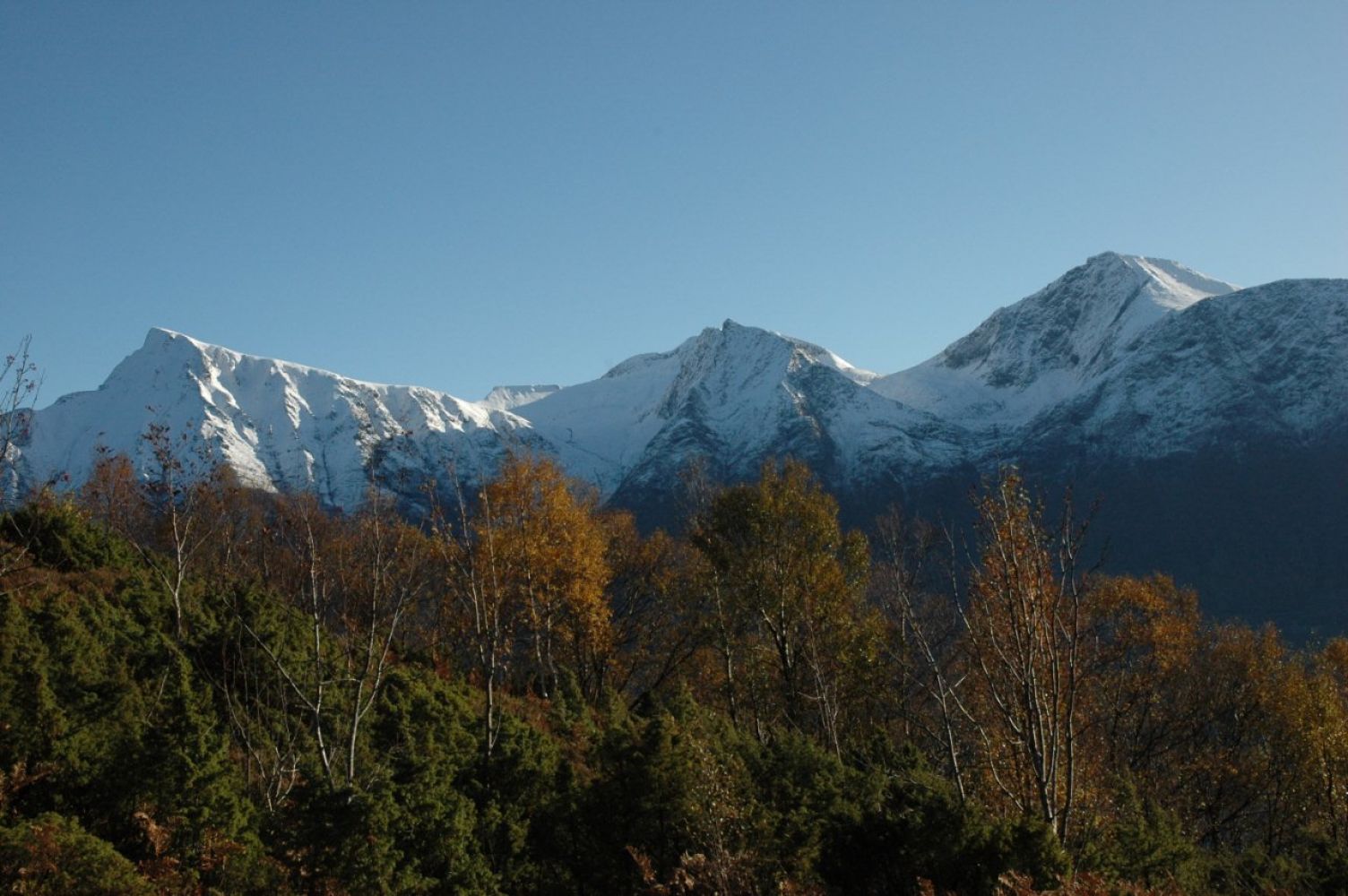
This route leads along a gravel road where the main experience is a great view about halfway up. When you reach the top of Alskleiva there are views of the fjord and Vartdalsfjell to the southeast and Snipsøyrvatnet and Hareidsdalen to the north. The trail leads you through a varied deciduous forest with thick foliage, especially along the warmer southern slope.
From the top, there are hiking trails along the terrain to lovely mountain areas both to the south and north. The trail is about a hundred years old and includes signs explaining how the road was used in the old days.
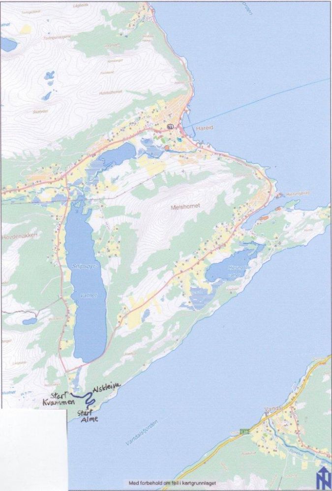
The trail destination is the summit of Alskleiva, but it can be reached from two sides, Alme and Kvammen. You can hike from one starting point to the other, and back the same way. Or just up to the top and down on the same side.
The route takes you along a gravel road with no difficult sections. At the top of Kleiva, where the terrain flattens, there is a viewpoint, a campsite and marked trails.
You can either start at Alme or the opposite end, in Kvammen. It is a 15 km drive from central Hareid via Hjørungavåg. First, drive 4 km from Hareid towards Ulstein and follow the sign to "Kvammen". Then continue another 7 km.
On the Kvammen side, there is a smaller parking area at the trailhead, or you can park on the side of the road.
On the Alme side, park on the side of the road or in the partly private parking area. If you use the private parking space, make sure to get approval from the landowner.
Duration
1 t. 5 min.

| Surface type |
Distance |
| Sti |
1 |
Ålesund, Page 119 I, M711
 Driving directions
 Route data
GeoJSON
Route data
GeoJSON