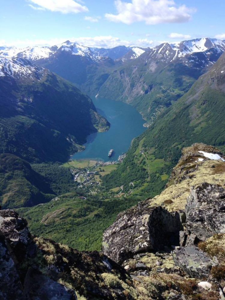
Note that the trail opens only around 1 June because of the snow. The view from Mount Vinsåshornet is truly magnificent. If you follow the ridge further east from the top and down to Grinddalen, you will see ancient bow shooting posts, an animal trap and a rock shelter on your way. This cultural heritage can be up to 5000–6000 years old. This route is also marked with “V” letters. You will also walk past the farms Holebakkgardane, Litlesætra and Grinddalssætra which were all hit by an avalanche.
The trail starts from Hole Hytteutleige Cabin Rentals on Vesteråsvegen Road. After walking for about 100 m, turn right and follow the forest road for about 500 m. You can choose to either walk through Holebakk (two farms that were hit by an avalanche in 1907 when 10 people died and only a barn remained standing) or just follow the forest road until it ends. 200 m after the end of the forest road, you will walk past Litlesætra. This summer mountain farm was also hit by an avalanche in 1907. 300 m long Briklabakkane lie above the farm. Once the hills end, the path flattens out and remains flat almost all the way up to Grinddalssætra at 820 m a.s.l. From here, the path goes through gentle terrain until it reaches the bridge over the river. After about 400 m the path splits in two*. The black route goes to the right. The ascent to the top starts shortly after the turn. You will then come up onto the ridge. From there, you will only need to follow the “V” letters. There will be some gentle climbing along the way. You will find the trail journal at the second cairn, 1343 m a.s.l. If you do not want to walk the same way back, you can follow the ridge eastwards until the point where “V” letters mark the way down to the left. Follow the “V” letters and the description marked with an asterisk below (*). Walk in the opposite direction down to Grinddalen. Continue walking straight ahead if you want to see the ancient bow shooting posts.** *If you want to avoid climbing up the open mountain ridge, take the turn to the left here (the red route). After about one km the path starts gradually climbing up. This is where you will see the rock shelter, GPS 32 - 409471 - 6885011. This used to be a natural overnight shelter which was presumably used in combination with the animal trap located a little further up, GPS 409517 - 6884634. The animal trap lies in the scree area where the path starts to climb right up. A migration route of reindeer used to run through here in the old days. Once you climb up onto the ridge, turn right to get to the top. **If you walk for about 500 m to the left and follow the “V” letters, you will come across several bow shooting posts, GPS 409500 - 6884109. These are parts of a hunting structure where the hunters were lying behind the stones and waiting with their spears for the reindeer herd to run towards them.
The trail starts from Hole Hytteutleige Cabin Rentals.
You can park your car along County Road 63 (Fv63) or next to Hotel Utsikten.
Duration
5 t. 40 min.

| Surface type |
Distance |
| Sti |
4 |
Tafjordfjella 2533, Stranda municipality tourist map
 Driving directions
 Route data
GeoJSON
Route data
GeoJSON