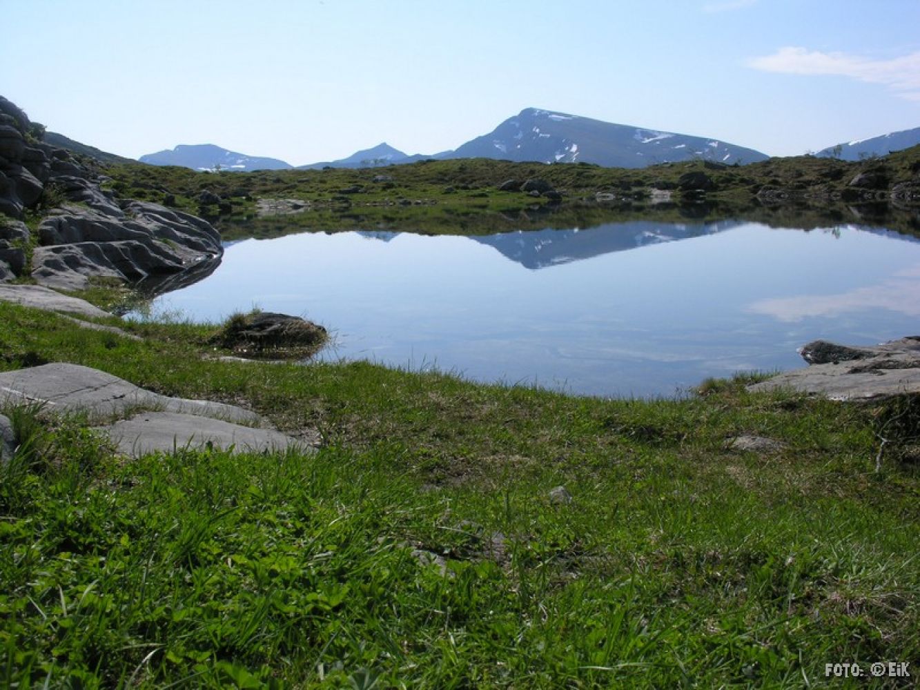
Trollkirka, the limestone caves in the Trolldalen Valley, is one of the most popular hiking destinations in the former Fræna Municipality. Please bring a torch and a helmet if you want to visit the caves. Afterwards, you can also take a walk to the scenic lakes just above the caves. This is an amazing swimming spot and a perfect rest area on a hot summer day.
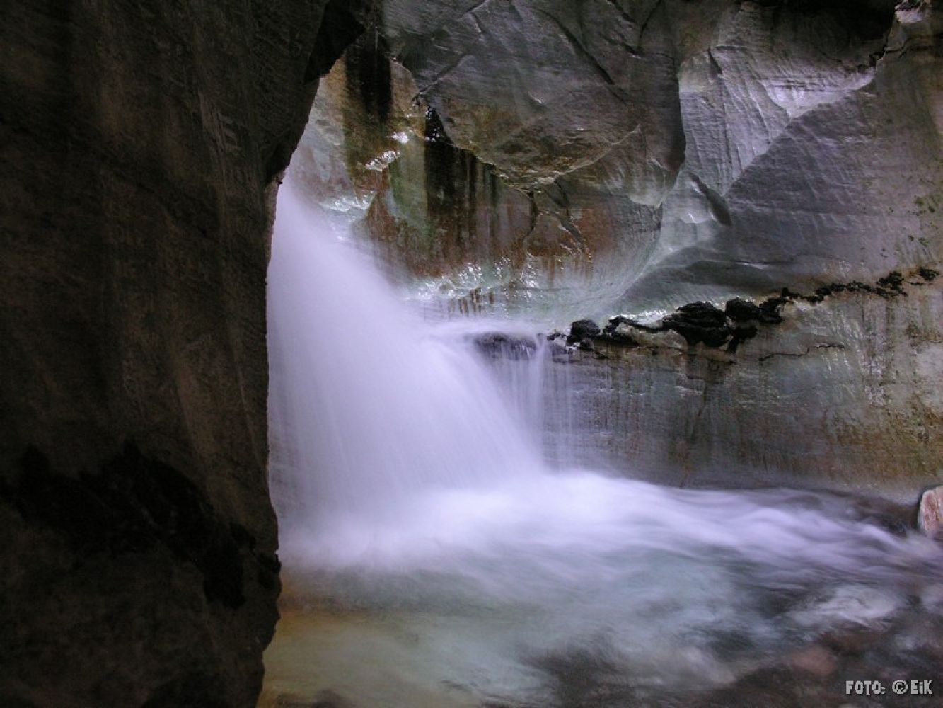
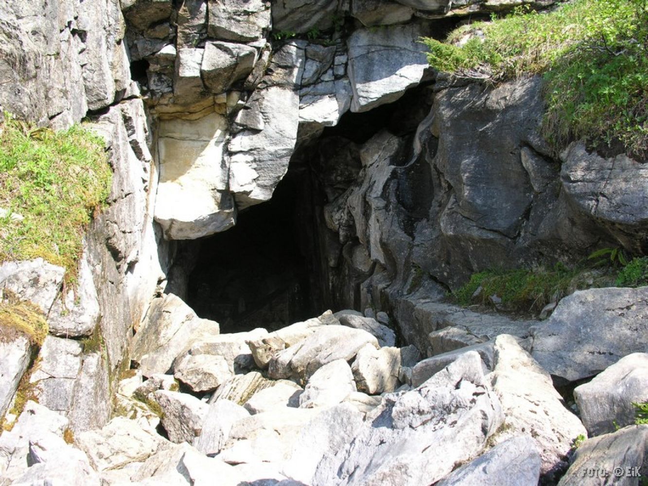
The trail starts along a hiking path/farm road 300–400 m before you turn off onto a path and cross the Moaelva River over the footbridge. Follow the path through the spruce plantation before the ascend to Trolldalen begins. Follow the partially rugged path and wooden footpaths until you reach the first entrance to the limestone cave. This entrance leads to a 40-metre long S-shaped passage that ends with a beautiful waterfall in a larger marble cave. You will need a torch to visit this first passage. If you walk past the first entrance to the cave, you will find another entrance 30 m further up. There is a ladder here so you can climb down to the waterfall and watch it fall further down the cave. No torch is needed here. On the surface above these entrances, you will also find a third entrance. This one leads you straight down to the beautiful limestone formations. This cave is narrower and may seem “scarier”. You need a torch to enter here.
There are a lot of hikers with limited experience visiting Trollkirka. This hike is intended to be approximately 3 hours round trip to the car park. This is without breaks. It may therefore be a good idea to bring food and drink with you. The hike also goes over the tree line in rough terrain. You must therefore take into account that the temperature, wind and weather may be different from where you start your hike. Extra clothes and good hiking boots are recommended.
From the roundabout in Moen, drive in the direction of Eide for about 2 km. You will see a large sign and a large car park on your left (the northern side of the national road).

| Surface type | Distance |
|---|---|
| Sti | 5,8 |