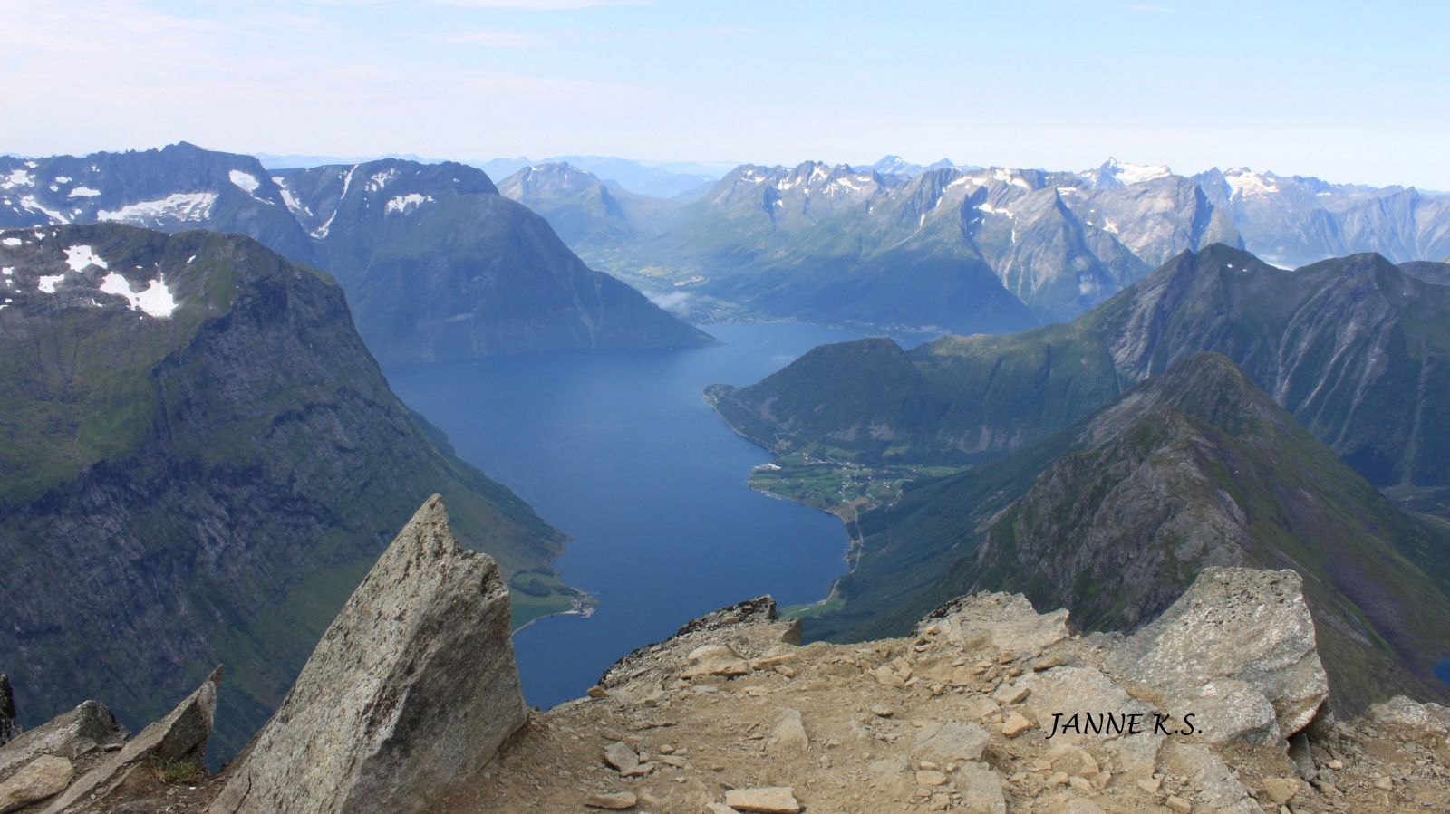
Slogen is one of the most visited peaks in the Sunnmørsalpane mountain range and is on the top 10 list of the best mountain hikes in Norway. The mountaintop offers a fantastic view of the Norangsfjorden in the west, the Brekketindane massif in the north, the Smørskredtindane massif in the east, and Mount Jakta in the south.
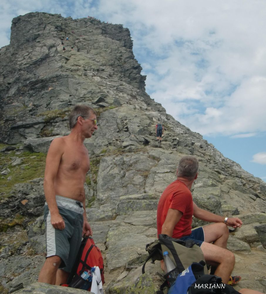
The summit hike to Slogen can be hard on the feet. The average incline from the car park to the peak is 22 degrees overall and about 38 degrees throughout the final 100 metres. The final section features a 10-metre long ascent with an incline of up to 60 degrees which requires some easy climbing, but many people manage it without supporting equipment. The number of people on the small plateau at the top should not exceed 10 at a time, so wait for your turn to climb the peak if there are too many people.
The trail follows a path called Slogråsa. Start walking from the car park. Walk over the road and past a house and continue east over the cultivated field until you reach a barn. Turn left and walk through the forest. The path is easy to find all the way to the top. The only opportunity to fill up your water bottle on this hike is at a height of about 600 m a.s.l. Please note that the water spring can be dry in summer.
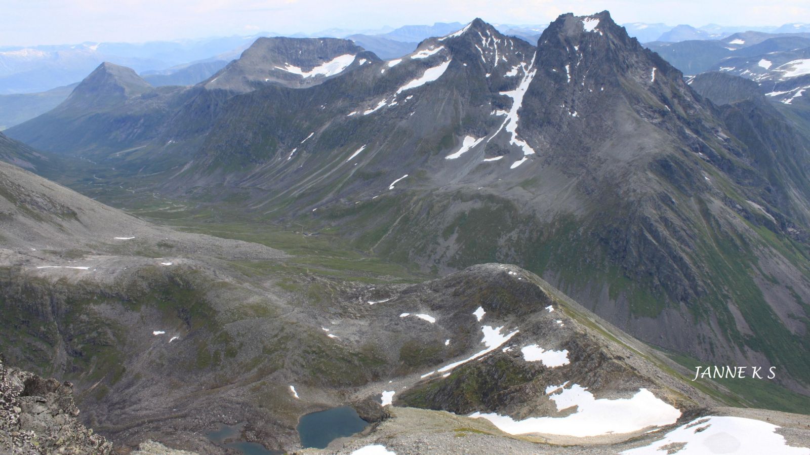
The path continues up the steep but easy terrain. When you reach the edge of the mountain east of Slogen at about 1200 m a.s.l., you will meet the path that runs from the Patchellhytta cabin. This is a nice place to stop and study the remaining part of the route. From here, the path runs over mostly rocky terrain. Early in the year, you might also need to cross glaciers. Be aware of the danger of slipping on hard-packed snow. The path now runs westwards up to the peak. It can be wise to stop before the final steep ascent to inspect the route and decide where exactly you want to go. You need to be confident in your route choice here and use your hands for support. Follow the same route back to the starting point.
From the west: take E39 to Ørsta Municipality. Turn off the main road in the centre of Ørsta at the sign for Sæbø and drive along FV655 to Sæbø. Take a ferry to Leknes and follow FV655 until you reach Øye. You will find the car park on the right side of the road about 1 km east of the centre of Øye.
From the east: turn off from FV60 about 4 km west of Hellesylt and take FV655 in the direction of Øye. Stop at the car park on the left side of the road about 1 km before you reach the centre of Øye. A parking fee applies.
Leave your car at the paid car park along the southern side of FV655 where the hiking path begins.
Duration
5 t. 30 min.

Signage
No signage or markings
| Surface type |
Distance |
| Sti |
7 |
Remember to bring water since it is difficult to find it near the path.
You can also check the route to Slogen from Patchellhytta in Stranda Municipality.
Sunnmørsalpane East, M711 1219 III, sunnmorskart.no
 Driving directions
 Route data
GeoJSON
Route data
GeoJSON