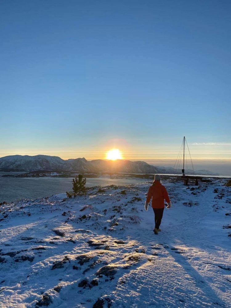
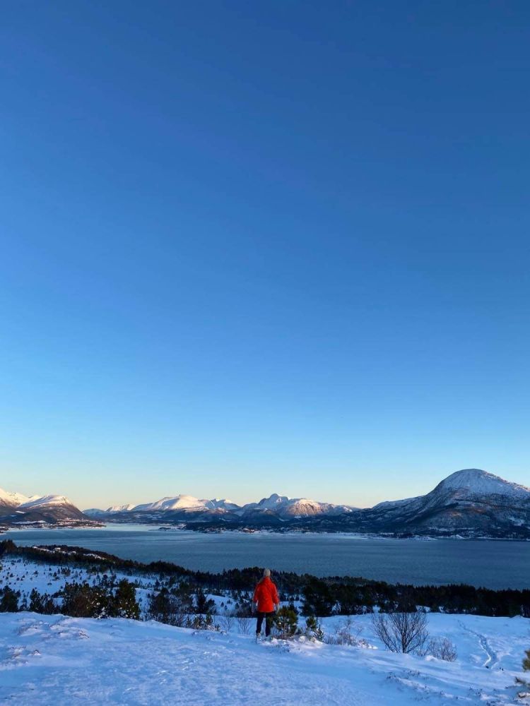
Jærmannburet with its 99 masl is the highest point on Gossen island. This is a nice hike that is suitable for most people. It starts on a gravel road and ends up on a path through the terrain up to the top. At the top of Jærmannburet there is a beautiful view of the entire island with a backdrop of majestic mountains to the east towards Vestnes and of the sky that meets the open ocean to the west.
Route description
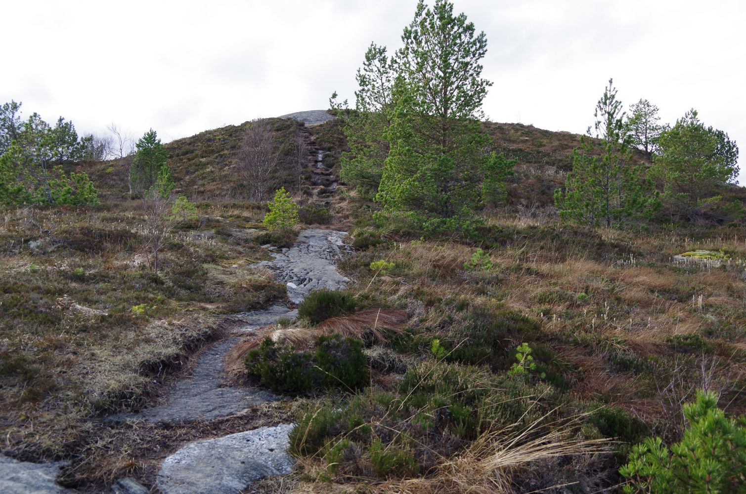
From the parking area, follow the gravel road up to the top of Jærmannburet. Just before the elevated water reservoir, before the end of the gravel road, there is a trail to the right that leads to the top of Jærmannburet (99 masl). Follow this trail to the top. Alternatively, you can do a loop around Jærmannburet: From the parking area at the crossroads at Hoksnes, follow the gravel road past the trail (possibly taking the trail to the top of Jærmannburet first) and up to the elevated water reservoir that is located at 68 masl. Here there is a rest stop with an information board, benches and tables. You can follow the trail through the woods and down a hill, and continue through the neighbourhood on an asphalt road. At the playground and lean-to, turn right and continue down to the main road. Take the pedestrian and cycling path back to the crossroad at Hoksnes and the parking area.
Access and parking
The route starts from the parking area at Hoksneskrysset. When driving from Aukra ferry quay, follow the signs to the Nyhamna/Ormen Lange facility. Hoksneskrysset is approx. 2.5 km before Nyhamna. Looks for signs on the main road marked Jærmannburet.
Marked parking area at Hoksneskrysset. No parking fee.
Hiking route
Green
Distance
0,83 km one way
Elevation
65 m
Duration
25 min.
Sesong
Winter, Spring, Summer, Autumn
Highest Point
99 masl
Signage
Signed
Map route
Surface type
Distance
Grus
0,5
Sti
0,5
Public transport
Ferry route 31 Hollingsholmen- Aukra and bus. See Framm.no for schedules.