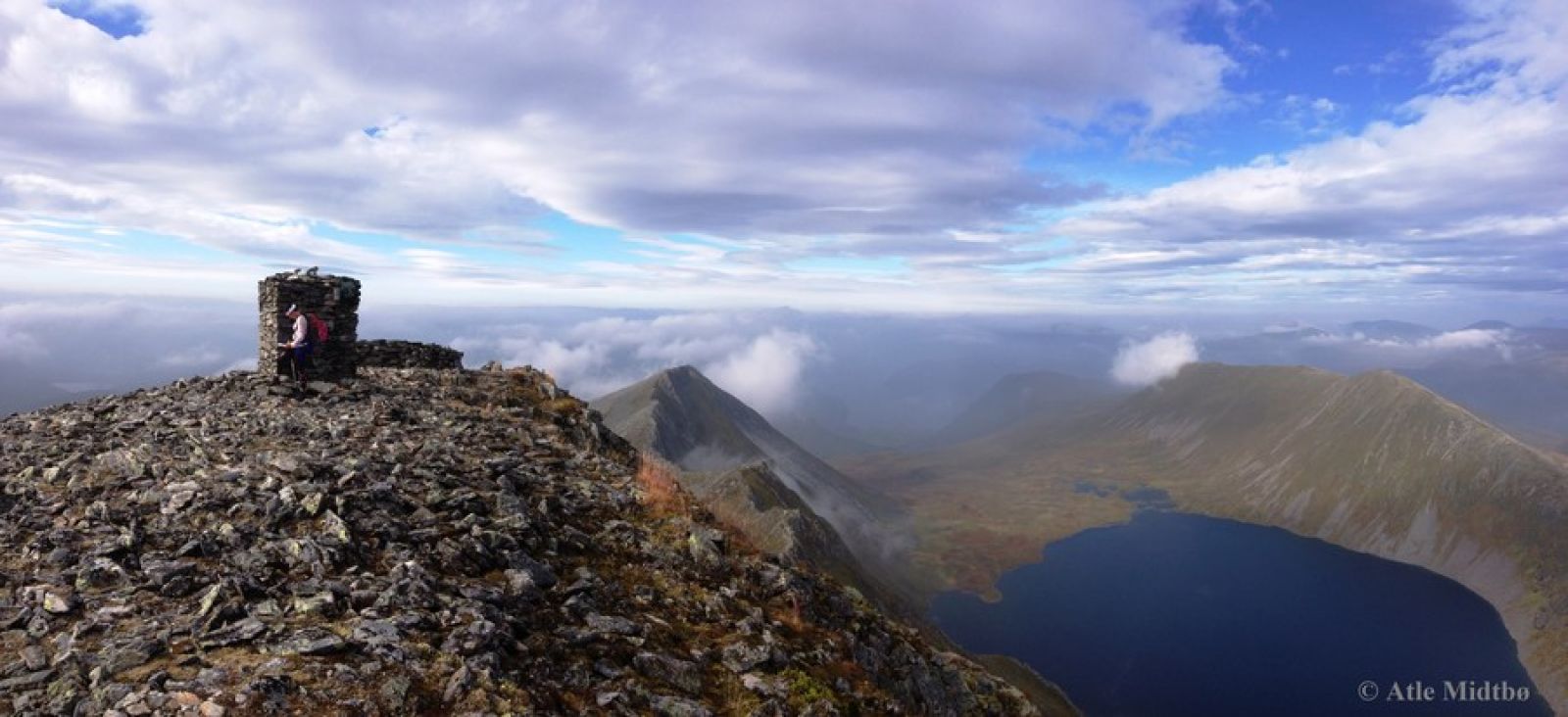
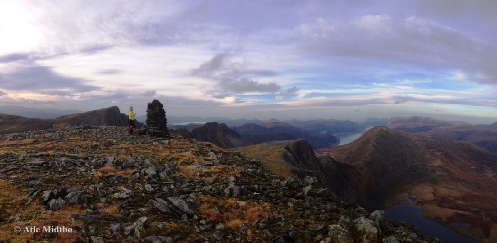
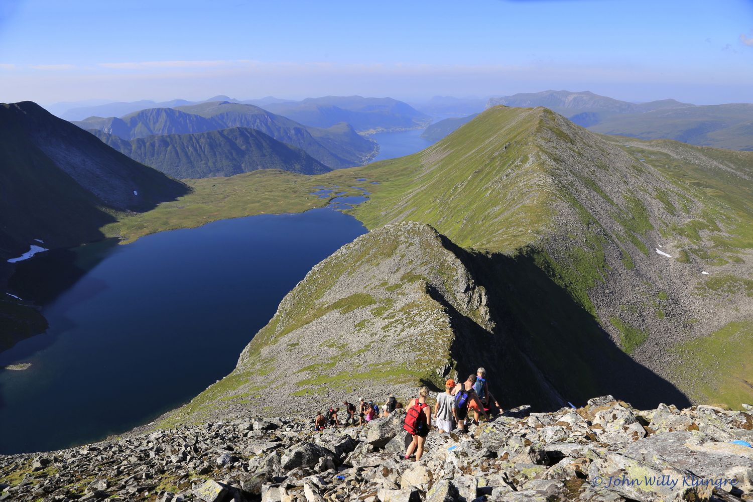
The starting point of the trail is at the car park at Røfsdalsætra (Ripsdalssætra). Follow the sign that reads “4 over 1000”. The well-defined path begins on a slope above the cabins. It is marked with blue paint on stones and sticks. Cross a small river which may become broad after a heavy rain. As you walk further, the path will climb fairly steeply and you will ascend quite fast. A nice place to take a break is by the Tåbrothytta cabin. From here, the path will take you over some areas of bare rock before it flattens out as you start walking into the heathland toward the Blæjevassbu cabin. As you walk through the heathland, you will come to an intersection of paths where you need to follow the sign for Lisjeblæja. Up on Vaspesnakkane, the marked route runs along the foot of Mount Lisjeblæja. From here, walk through a steeply ascending section of heathland which gradually changes to a rough scree and mountain area. There are sections where you will need to do some easy mountain climbing when you approach the top of Lisjeblæja. From Lisjeblæja and Blæja, you will primarily follow the edge of the mountain. The area between Klungrepassasjen and the top of Mount Blæja involves some steep sections with easy mountain climbing.
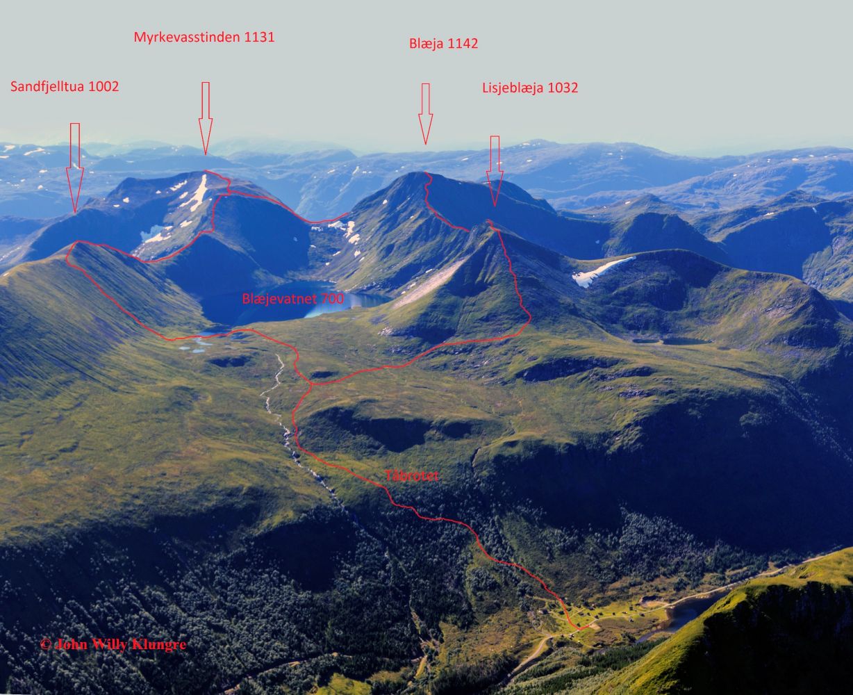
http://mrfylke.no/Morotur/Turar/Blaejeegga-luftig-tur-langs-egg-og-rygg-Lisjeroefsdalen-Lisjeblaeja-Blaeja-Myrkevasstinden-Kvanndalen From Blæjeskaret, the route continues up through the plateau on your way to Blæjeskartinden. There is an intersection of paths here with a sign for Myrkevasstinden and Sandfjelltua. Take a detour to the right towards Myrkevasstinden to find the trail checkpoint, then return to the intersection of paths and continue down the steep mountain side in the direction of Sandfjelltua.
http://mrfylke.no/Morotur/Turar/Sandfjelltua-via-Blaejevatnet From the top of Sandfjelltua, you will come down to Sandfjellegga. This is where you will find another intersection of paths with a sign for Røfsdalsætra. Follow the marked trail down a steep heather-covered slope (300 altitude metres) and past Olavskjelda.
http://www.syvdeil.no/index.php?option=com_content&view=article&id=105&Itemid=120This is the most convenient place to cross the river that runs from Blæjevatnet. Follow the marked trail via the Blæjevassbu cabin and further north until you come to the intersection of trails where you started walking.